tv Fox Morning News at 5 FOX September 30, 2010 5:00am-6:00am EDT
5:00 am
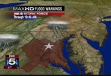
the entire area. we'll have more on all of this coming up in just a couple of moments. this information is fluid and changing moment by moment literally. >> all right. thank you. appreciate it. stay with us. fox 5 morning news at 5:00 continues right now. we'll get you started with a live look outside. be extra careful when you head out today because rain is coming down really hard in many spots. good morning. i'm gurvir dhindsa. >> i'm allison seymour in for steve chenevey today. welcome to fox 5 morning news. >> let's go straight back to tony. >> the flash flood warning is in effect for washington, d.c., montgomery county, southern anne arundel county, prince george's county, calvert county, fredericksburg, king george county, the city of alexandria, fairfax, falls
5:01 am
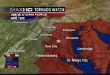
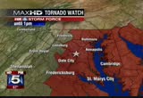
church, arlington county, loudoun county, fauquier county. i'm reading this to you because this just broke and we don't have the map ready yet. prince william county, fairfax county, even fauquier county. this is a flash flood warning. this is in effect until 10:45 a.m. this moons that flooding is imminent or has been observed already. you want to know that. flash flood warning in effect for essentially all of the area. and a tornado watch now in effect -- let's see. i'll let you know how long that is in effect just shortly. that includes washington, d.c., anne arundel county, prince george's county. that is in effect until 1:00. let's get to max 2. we can show you that map there. the areas covered by the tornado watch in effect until 1:00 this afternoon. what that means is that conditions are good for the possibility of the formation of tornadoes. this is a watch. if we get any indication that there is rotation in the
5:02 am
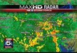
atmosphere or anything like that. we'll get a tornado warning but right now, it is a tornado watch in effect for most of the area particularly from washington to points east and then the close-in counties to our north, south and west. that is in effect until 1:00. let me let you know that a flash flood watch is in effect until this evening. a coastal flood advisory is in effect until midnight. a wind advisory is in effect from 6:00 a.m. until 6:00 p.m. let's go to ht radar and we'll show you the latest radar images. we knew we would get heavy rain and stormy conditions today. wave been telling you about it all this week. this is being enhanced by the remnants of tropical storm nicole we'll get significant rainfall. it is like an attempt to make up for the drought we've had all in one week being one day. we'll get close to it as a matter of fact for parts of the area as we could see several inches of rain, also strong gusty winds developing during the course of the day today. let's get to max 2. i want to show you the big picture
5:03 am
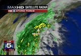
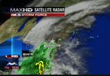
satellite-radar. there is so much moisture with this system continuing to train across our region, across the eastern carolinas. they are getting very hard hit. some of that rain is getting wrung out down there. but then it redevelops as it moves across the delmarva from our area up into the northeast. as can you see, it is moving from the south to the north over the same areas where we've been getting it for the last several hours. so that is the problem. that is why we have these flood warnings and watches in effect for this morning. so continued rain being heavy run during the course of the morning. windy conditions developing during the course of the day. by later on this afternoon of course we'll have scattered rain showers hopefully. that is what we believe. the bulk of the heavy rain will be during the morning hours. we'll get you more information on all of this coming up in just a little bit so stick with us. >> okay. thank you so much. the roads are scary out there this morning. >> julie wright is with us with those details. how is it looking out there? >> not good at all, ladies and
5:04 am
tony. if you are traveling eastbound i-70, a fuel spill occurred after the exit for 29. eastbound i-70 is still closed at this point while clean-up continues. new wreck to report on the inner loop of the beltway before you commit to go northbound on 270 at democracy boulevard. this one possibly involving awe jackknifed tractor-trailer. behind me, this is the northbound side of i-95 approaching dumfries. accident activity involving this tractor-trailer. two right lanes are closed at this point. already traffic stacking up out of stafford headed northbound along i-95. two separate accidents now reported in virginia, eastbound 66 before you reach marshall and then before the plains. the pounding of the water, on the left, on the right side of the rooted, in the cent are of the road, it is a mess out there. people are driving too fast at this hour. even though we don't have a lot of volume out there, people are driving too fast to control the
5:05 am
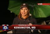
vehicle. do keep that in mind. beltway here at old georgetown road, no problems to report on the inner or outer loop of the beltway. that's a check of your fox 5 on-time traffic. more on how this nasty weather ill impact your ride to work. >> there are flooding concerns in many of the usual places and that includes parts of rock creek park. sarah simmons is live near beach drive. >> reporter: as can you probably imagine, this area has already been shut down. beach drive right as you are around rock creek park. i was talking to the park police officer would is here at the scene where they've got this area closed that they did this starting at 1:00 a.m. just in anticipation of the flooding they were going to be experiences. can you see the rain is coming down pretty hard. it is not as flooded back there further down where we have seen it in the past although they do anticipate that the water could very easily rise here over the next several hours as the rain continues to come down. i also talked with u.s. park police. they are telling me that rock
5:06 am
creek drive and beachin the district are also closed. another low-lying area where water will obviously tent tend to collect as we get more and more of it. also, hopefully, people heeded the warning yesterday and prepared for this. sandbags were being handed out in the district. lots of people hopefully have gotten that you are gutters clean cleaned out, any leaves that would be blocking areas where it would allow the rain to be able to drain. the roads will be stretch ruses u.s. as julie has mentioned. people to seem to be driving at a fairly good pace out here but keep in mind, the areas that you are very familiar with, that do tend to flood on your drive in to work, they are probably going to be flooded this morning. the ones i know of were definitely flooded this morning. take precautions as you head out there on your morning commute. back to you guys. >> thank you. we want to see what the weather is like in your neighborhood. if you have flooding or if you have trees down, can you upload
5:07 am
pictures and video to myfoxdc.com. just check under the weather tab. right now, we want to check in with our stacy cohan on the scene of the bus accident yesterday. she is in bethesda this morning. stacy? >> reporter: good morning. anybody that was stuck in the terrible afternoon commute knows about the terrible fatal bus crash here on 270. i'll have the latest from the scene in a live report coming up on fox 5 morning news. d
5:09 am
what? no, no. you gave him fiber. no she didn't. this tastes way too good to be fiber. they're delicious crunchy clusters with sweet honey and half a day's worth of fiber. you care about my fiber? not really. i care about your fiber too. i have for a while. ok, carl. why don't you care about her fiber? hey carl. [ male announcer ] fiber one. cardboard no. delicious yes.
5:10 am
big story this morning, the horrifying crash on i-270 in montgomery county. a bus driver was killed, several others hurts when their tour bus veered off the highway falling nearly 40 feet. investigators from the ntsb are taking the lead to figure out what happened here and our stacy cohan joins us live again from bethesda with the latest. good morning. >> reporter: good morning. you can see that the traffic is moving. the lanes were reopened overnight around 1:00 in the morning and most signs of that accident have now been cleared but it was just a certainly scene. here what is it looked like just after rush hour, during
5:11 am
afternoon rush hour right after the accident. it was a limousine-style bus carrying 12 tourists who were here in our city visiting. this were mostly children and some adults heading from the bethesda area on a fly overramp on northbound 270 when the bus veered off the ramp and toppled and plummeted 45 feet below crashing down on the highway. one person was killed, the driver of that bus. several people taken is to hot, two with life-threatening injure usc. there were several people on the roadway at that time and some hiewt ares even pulled over and stopped to help. -- command commuters even pulled over and stopped to help. >> again, that was stacy cohan reporting. we'll be talking more about this accident coming up a bit later on. we have much more straight ahead this morning. the race for governor in maryland, martin o'malley has opened up a lead in the polls.
5:12 am
>> but as you might expect, challenger bob ehrlich is downplaying the late numbers. we'll hear from both candidates. we'll get the latest on today's weather conditions actually lot going on this more -- morning. we'll run that down for you in just a couple of moments. julie wright will tell you about this morning's road conditions. stay with us. fox 5 morning news will return. right now, it is 5:11. lysol believes that kids shouldn't miss school days
5:13 am
during cold and flu season. that's why we started a mission for health. by going beyond clean surfaces to healthy surfaces. by making a healthy way to wash hands. and even by working with a pediatrician to develop lysol healthy habits initiatives in schools. when you use lysol, you're a part of something bigger. for healthy tips and more, visit lysol.com/missionforhealth.
5:14 am
5:15 am
the all-new cr-z sport hybrid. ♪ [ woman vocalizing ] welcome back. the roads pretty clear there from our tower cam. it is early still. but when you to head out there, please take your time. the rain is really coming down. we can hear it on our roof as a matter of fact. >> lots of pooling water out there on the roads, tony. and i know from my commute in
5:16 am
and probably from yours, a lot of struck spray. >> yeah, we've got heavy rain across the area. we've got treacherous weather conditions and they will be with us for a few hours. we have a special marine warning in effect for the chesapeake bay. this is because of a attention deficit hyperactivity disorder indicated thunderstorm that was possibly produce a waterspout north of point lookout moving to the north at 40 knots. i have not had an actual observation. no one has reported it but the possibility of a waterspout near patuxent naval air station. so that special marine warning in effect until 5:30. a bunch of other warnings and watches in effect. i want to start by going to max 2, going to our graphic, showing you the area covered by a flood warning. this is a flash flood warning that is now in effect for most of the area. all the counties that you see
5:17 am
shaded in there including the district of columbia. this flash flood warning is in effect until 10:45. it is because of the heavy rain that we've seen already. the heavy rain that we expect to see touring the next several hours can easily lead to flash flooding, particularly in areas that don't drain very well. so you want to be aware of that. that is a flood warning. flash flood warning in effect until 10:45 for most of the viewing area. now, we'll stay with the graphics. we'll go to the next one. a tornado watch. we already had a turn tornado warning for some areas east of the district that. expired. before a tornado watch in effect for all of the counties you see there including washington, d.c., including baltimore, dale city, annapolis, alexandria, fairfax. this tornado watch is in effect until 1:00 p.m. because conditions are ripe for the possible formation of tornadoes. if we see rotation in the atmosphere, the national weather service will issue a tornado warning.
5:18 am
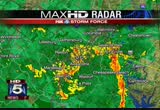
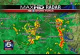
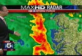
but this does include d.c., fairfax county, prince william county, stafford county, and many more. let's get to hd radar. we can show you, you probably her it on your roof, on your windows, heavy rain, all of washington, d.c. under very heavy rainfall. the district, points just to the north and just to the south. we foe parts of alexandria are prone to flooding so you want to be aware of that. up to our north, montgomery and in parts of prince george's county, very heavy rain at this hour. southward, really along 95ings where we continue to see some more heavy rain and then out to the east where we've been very hard hit and i have to tell you we're very concerned about our friends to the east in prince george's, anne arundel, kal vrt county, charles county because the heaviest of this rain is just training along this area. that is where we had the tornado warning earlier this morning where we're likely to
5:19 am
see more problems. you see the long line of heavy rain extenting from severna park, through annapolis, chesapeake beach south to patuxent naval air station. that is where we're very concerned about that heavy rain continuing to move to the north and where we're going to continue to watch these very strong storms. there is lightning with this storm town to our south as well so we'll keep our eyes on that. now, a wind advisory. let's talk about that. we go back to the graphics. wind advisory in effect primarily to the east as the day develops. our winds will pick up. there is a tropical system down to our south that is moving northward and we'll see our winds gusting up to 40, 45, maybe even 50 miles per hour so that wind advisory goes into effect 40 minutes from now and will be in effect until 6:00 tonight. in addition to that, there is a coastal flood advisory in effect until midnight tonight. here is your big picture. can you see we're not done with the rain yet. this rain is moving in from the south and will continue to do so. tucker and i feel the heaviest
5:20 am
rainfall amounts will be during the course of the morning but straight through the morning. your forecast for today, flash flood watch and a flash flood warning actually now. flash flood warning in effect. rain heavy through the morning hours. possible thunderstorms and some could be severe. windy at times. winds gusting up to hor. high temperature today, 76 degrees. we'll have more on all of this. coming up in a little bit. >> okay. get that machine a mountain dew and a fan. >> he doesn't even like mountain dew. >> we'll get through it. >> julie wright is checking out the roadways. it is another half of the story. with the rain comes those sort of dangerous driving conditions. >> not sort of, honey. it is dangerous out there. not only are we dealing with the pooling of the water across the highways but in some areas, people are simply driving too fast. before everyone gets out on the roads, it is kind of like a free for all out there.
5:21 am
it is very dangerous. i got scarred a couple time on my way into work along 270. you won't get anywhere fast today at all. a number of accidents are all over the place. northbound i-95 here at the occoquan. this fellow is spun out facing the wrong way. he is perpendicular across the highway. only one lane to the right is getting by. before you reach this area, there is a crash 95 before 234 dumfries. that one involving a tractor- trailer. only the left side of the highway is able to get through. if you are traveling in maryland, you will find that the accident activity that we had was actually on the inner loop of the beltway before you reach 270 and that activity has traffic squeezing by under police direction. eastbound i-70 at 29, accident activity involving a tractor- trailer. it flipped over losing a load of milk. westbound route 4 before 258 for the crash. right side of the roadway there blocked. a portion of beach drive already closed down because of flooding between franklin street and the d.c. line. that's a check of your fox 5
5:22 am
5:23 am
words alone aren't enough. our job is to listen and find ways to help workers who lost their jobs to the spill. i'm iris cross. we'll keep restoring the jobs, tourist beaches, and businesses impacted by the spill. we've paid over $400 million in claims and set up a $20 billion independently-run claims fund. i was born in new orleans. my family still lives here. i'm gonna be here until we make this right. key lime pie, pineapple upside down cake, raspberry cheesecake... ...yeah, every night its something different. oh yeah yeah...she always keeps them in the house. no no no, i've actually lost weight... i just have a high metabolism or something... ...lucky. [ wife ] babe... ♪ umm, i gotta go. [ female announcer ] over 30 delicious flavors at around 100 calories each. yoplait, it is so good.
5:24 am
5:25 am
wet roads. tony perkins will be in to tell you more about the rain out there. rupert murdoch and michael bloomberg will testify at a hearing today on the role of immigration in strengthening america's economy. mr.murdoch and mayor bloomberg formed a new coalition over the summer to push for immigration reform. news corp. as the parent company of fox 5. there are new developments this morning in the race for maryland governor. a new "washington post" poll shows democratic incumbent martin o'malley way nine-point lead over former republican governor bob ehrlich. tom fitzgerald has the latest now from the campaign trail. >> reporter: on the campaign trail in frederick, maryland, democratic governor mart uno'malley has reason to feel optimistic about his chances for re-election over republican robert ehrlich. >> we are moving forward, not back. >> reporter: that message referred to maryland's economic future but could also apply to
5:26 am
the governor's political future. a new "washington post" poll finds owe ma'amy has jumped to a nine-point lead. >> post poll is an encouraging sign. it is a nap shot in time but i do think that families throughout our state are asking the question, which of these two candidates is on our side to get us out of this recession and move us forward to better times. >> reacting to the polls showing him behind, the former governor downplayed the number. >> we don't vob obviously comment on polls. we haven't. i guess i'm violating that rule. that poll is owe far out of the whack with every public and private poll we've seen over eight months. >> reporter: throughout the sum, polls had shown ehrlich and o'malley neck and neck with only a small marne unseparating them. >> it is not the summer anymore. >> reporter: the polling director of the "washington post" says the survey found, unlike his first race for governor, ehrlich is not getting enough maryland democrats to cross party lines. >> only getting 10% of those tempts.
5:27 am
when he won in 2002, he got 2 #% of all democrat you can votes to go his way. that really propelled him to victory. >> reporter: awe victory that could prove difficult for republicans to pull off. democrats keep their party faithful on election day. tom first gerald, fox 5 news. president obama, who remains popular among maryland democrats, will campaign for o'malley at a rally in prince george's county next thursday. o'malley campaign radio ads featuring the president will soon be airing in the d.c. market. fox 5 storm force is out in force on this thursday morning. sarah? >> reporter: as can you see, the rain is really coming down this morning. with that comes the fears of flooding. i'm sarah simmons. i'm have a live report on where some of the road because are already closed down. plus a commuter bus plunging off a sky ramp on the d.c. beltway. we'll have the latest on this deadly crash. you are watching fox 5 morning news. you want some fiber one honey clusters?
5:29 am
yeah. you must really care about him. what? no, no. you gave him fiber. no she didn't. this tastes way too good to be fiber. they're delicious crunchy clusters with sweet honey and half a day's worth of fiber. you care about my fiber? not really. i care about your fiber too. i have for a while. ok, carl. why don't you care about her fiber? hey carl. [ male announcer ] fiber one. cardboard no. delicious yes.
5:30 am
it is thursday morning, september 30, 2010. that is 395 at seminary road. wet roads out there across our area. lots of ponding throughout this morning. >> that can be so dangerous. you can be cruising along, too fast in some cases, and your car gets into that skid. just be careful out there. >> the rain come down pretty hard in some places. >> yeah, it is.
5:31 am
we'll see heavy rain throughout the course of this morning in particular, possibly into the afternoon. first, let me just mention the special marine warning that of a been mentioning has been canceled. that was for portions of the the chesapeake bay. we were talking about the possibility of a waterspout. that marine warning has been canceled. but we have a whole glut of other warnings and watches. we'll go it our graphics and start with the flash flood warning in effect until 10: 45 this morning. it is for nearly all of the area. i want to go to the graphics, max 2. there we are. the counties in brown including the district of columbia, flash flood warning in effect until 10:45 this morning with the heavy rain coming across the area in low-lying areas. anyplace where drainage is not good. flash flooding could occur at new moment so you want to be
5:32 am
aware of that. we'll stay with the graphics now. show you the area covered but a tornado watch. that is in effect until 1:00. that does include washington, d.c. and most of the close-in counties particularly to our north, south and east. out to the we, it does include fairfax county, parts of fauquier county, places like that. i will mention this. for those of you with relatives down there, there is a tornado warning in effect until 5:45 around the virginia beach area this morning for virginia beach, norfolk and the eastern city of chesapeake. so that is a tornado warning in effect down to our south and east. now, let's get to hd radar. i just want to mention while we are atalking about these tornado watches that are in effect, this is how widespread the system is. tornado watch is in effect for portions of the district of columbia, delaware, maryland, new jersey and the costal
5:33 am
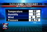
waters. we are particular will you currented about our friends in anne arundel county, calvert county, places like that where they continue to see -- look at annapolis, right now under the gun. cape st. clair under the gun with very heavy rain. they just keep getting the heavy rain. it has been consistent there. other parts of the area, you have heavy rain and lighter amounts of rainfall. most of the washington area is getting heavy rain. all of the areas in yellow and orange that you see, getting heavy rain. bethesda, mclean, vienna, arlington. that is what we're watching this morning. right now, current conditions being reported at reagan national airport, heavy rainfall. 69degrees. we are looking for a high today in the mid-70s. humidity, 93%. the wind are out of the north at eight but they will pick up during the course of the day today. they could gust up to 50 miles per hour. they could be up to 70 miles per hour in some severe thunderstorm situations. so you want to be aware of that
5:34 am
too. we'll get you the latest. tucker is taking in all the latest data as we speak. we'll get that to you in just a few minutes. >> i guess if there is any good news, this won't be a all-day event. >> we think primary irely in the morning hours. we do think later on in the afternoon, it will be lesser rainfall amounts appear than sporadic. >> that will be so good. julie wright has the latest on the roads now. >> it is okay. i just got off the phone with noah. he says he'll swing by in a few minutes with the ark. the ponding of water, and some places the visibility is less than a car length in front of you. we are already peppered with accidents northbound i-95 here at the occoquan. only the right lanes getting through northbound on i-956789 crash we had at dumfries is cleared but big delays coming
5:35 am
northbound out of stafford only to join this mess here. we have two separate accidents out on 66 before you reach marshall. you lose the left lane and before the exit for the plaindz, you lose the right side of the road because of the crash. inner loop of the beltway, accident involving a tractor- trailer after the exit for 270. that has traffic squeezing by under police direction. southbound # 70 at falls road in the main line, crash there blocking the left lane. -- southbound 270. it is like a laundry list of accidents that continue to come in this morning. we encourage you to slow down. if you have at built to work from home, today is the day to do it. >> i'm leaving. >> i wish we could. >> thank you so much. sarah simmons you see there in the top right hand pouring of your television screen. she is in kensington, maryland with a look at how things are there. >> reporter: good morning.
5:36 am
as you hear the rain coming down, it comes in waves, pounding one minute but it is still the stead ray yi rain and it has been all morning long. because of that, there is fears of flooding. -- the steady rain. they have closed beach drive at 1:00 a.m. in anticipation of of the flooding. we haven't even seen the worst of what they have seen in the past but they wanted to do this as a precaution. this is ths one of those areas that does seem to flood -- this is one of those areas that does seem to flood the first of any place. this is shut down being beach drive to the d.c. line to franklin avenue here in maryland. i also talked with u.s. park police. they say rock creek drive at beach drive was also closed. but again, we are seeing traffic starting to pick up quite a bit. people seem to still be going at a normal pace. that could be a huge danger. but as we head throughout the morning hours, keep that in mind.
5:37 am
the areas that you are familiar with on your commute that do tend to have standing water probably already do. either go a different route or keep that in mind and slow down as you head out this morning. back to you. >> thank you so much. we want to see what the weather is like where you are. we have an idea that the wet. we want to see what you are getting. if you have flooding or trees down, please upload your picture and video to our web site, myfoxdc.com. just look under the weather tab.
5:40 am
along with the weather, a big story making headlines, a bus driver is dead and several other people recovering after their tour bus plunged off i- 270 in montgomery county. investigators wanted to know why it happened. stacy cohan has the latest. >> reporter: this accident happened during rush hour yesterday afternoon. the accident scene was finally cleared overnight around 1:00 in the morning. so commute ares driving through here will not seat remnants of that but the memory of this accident will likely linger. take a look at what it looked like yesterday afternoon. this was a limousine-style bus. it was heading out of d.c. it had 12 passengers, tourists from pennsylvania and the drive ads well. most of those passengers were children. it was on the flyover ramp from bethesda heading to northbound 270 when the bus plummeted off
5:41 am
the ram. down 40 feet and crashed into the highway. one person was killed and that was the driver of the vehicle. twelve people were transported to the hospital, two with life- threatening injure usc. there were cars out on the roadway and some of the commuters actually stopped and tried to help. >> i had highself in the window and they handed a child to me and handed it today people on the ground. there were four or five children. when it starts to happen, you don't think how it is. you just have to do it. that's all. >> reporter: the but was tow ad hua to a montgomery county police investigating lot where they are going to go over it and try to figure out what happened. you are looking now back here live at a live shot of 270 although the accident scene is cleared now and the investigate investigation on this part is over. obviously, the uncredible rained are going to be your impact today as you head
5:42 am
through this part of 270. once gun, the driver of that bus, thomas -- excuse me. joseph clabaugh, jr., 66 years old, was killed in that accident. back to you. >> a tragedy for sure. thank you. straight ahead, more on our top story, the nasty weather. >> we'll check back in with tony and tucker for the latest on the forecast. we do have flash flood warning and tornado watches in pla there is a live look outside to show you what you are dealing with when you head out this morning. th.ou
5:43 am
four years ago, bob ehrlich got fired as governor of maryland. for good reason. first, he protected tax loopholes for giant cable cable companies. then, he let utilities jack up our rates 72%. and for the last four years, he worked as a hired gun for big corporations, even a bank that took billions from a taxpayer
5:44 am
5:45 am
nobody is really thinking about the temperature when you are dealing with driving conditions like that. take your time out there, folks. that is a look at 270 south in the beth he is that area right there at the split is what it looks like. all those brake lights. that is a good sign. i don't think people are going to want to speed at all today. so as a matter of fact, slow down. >> that traffic is pretty heavy this early. >> i would hope people -- you know, i heard someone yesterday saying it's just rain. it is rain but it is significant amounts of rainfall in a very short period of time and, if you've been watching, you know we have a whole slew
5:46 am
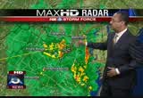
of watches and warning in effect. so it is a very unique situation where we have this enhanced low coming through which we knew was going to come through and during the last couple of days, we realized the remnants of tropical storm nicole are going to join with that. it has made for very dicey conditions out there. the win will pick up later on. we will likely see flooding. i should mention that we got a report just a short time ago of flash flooding occurring in a part of calvert county. some flash flooding occurring in calvert county. we'll see that throughout the course of the morning popping up across the region. let's start by looking at hd radar. we'll show you where the precipitation is right now. again, the areas that we're most concerned about are where we're seeing the yellows and oranges. that is where the heaviest rainfall is at this hour. i'll show you what we have here to the east. this area, portions of anne arundel county, calvert county, st. mary's county have just been getting this heavy rain
5:47 am
coming through during the overnight hours and now during the early-morning hours, just training across this area from the south up to the north. that is why we are seeing flooding occurring in those areas first. they've been bearing the brunt of it. and they continue to see heavy rain. meanwhile, from d.c. to points west, more heavy rainfall. not so much in the district itself right now but in western portions of the beltway out towards mclean, the tysons corner area, right here, vienna out towards reston up to gaithersburg, down to our south, dale city, anywhere where you see the little boxes with the you're owes pointing, that indicates likely some strong, very heavy rain, maybe some thunderstorm activity and it shows you the direction that those storms are going in. all of this from the south up to the north. it bears watching throughout the course of the morning as these stormy conditions continue to shift around. down near fredericksburg, you want to mention you had some heavy rain come through. right now, you are getting moderate to heavy rainfall coming through.
5:48 am
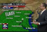
there you see fredericksburg right there. you are not done yet. more precipitation coming up through our region from the south. let's go to the graphics. we've got a lot to show you, a lot of to tell you about. flash flood warning. washington, d.c. itself is under this flash flood warning. prince george's county, montgomery county, fairfax county, stafford county, all of these areas under a flash flood warning until 10:45 this morning that. might be extended later on but until 10:45, flash flood warning. that means flooding is likely to occur soon or has been observed. we have observed it in calvert county. this is the flash flood watch. this is in effect through the evening hours today. it includes the entire viewing area because, with the amount of rain we are seeing, pretty much anywhere, you could get some flash flooding occurring again once we see the flash flooding is iminnocent or is occurring, that is when you get the warning. we do have the warning in
5:49 am
effect for much of the area until 10:45. in addition to this, there is a tornado watch that is in effect as we continue along with the graphics. tornado watch in effect for washington, d.c. the close-in counties once again, prince george's county, montgomery county, fairfax county, arlington county, all of this area under a tornado watch until 1:00 p.m. conditions are good for the possible development of tornadoes. we hay tornado warning early this morning. there have been tornado warnings in effect down near virginia beach where they've been getting hit pretty hard. no tornadoes have been spotted at this point but a watch is in effect until 1:00. new brunswick to that, we have a wind advisory that is in effect from 6:00 a.m. to 6:00 p.m. -- in addition to that, we have a wind advisory that is in effect from 6:00 a.m. to 6:00 p.m. one last look at the radar. we can show you the big picture of what is going on. there is your precipitation. a lot more moisture has to get
5:50 am
through here. we expect heavy rain through the morning hours. that is a look at what is happening with the weather. now, let's get an update on traffic from julie wright. >> a lot going on right now. we are very busy. out on the roads, we've got first of northbound i-95 right here in woodbridge. the accident moved over to the shoulder so out of the roadway but big delays from 17 north out of stafford headed up towards dumfries. eastbound 66, two separate accidents before marshall, you lose the right lane. you lose the left lane over at the plains. this is the latest crash. it is the inner loop of the beltway. what you know is that the inner loop of the beltway is at a crawl at this point traveling north of river road head up and around # 70. accident involving a tractor- trailer occurred after the exit for 270. that's a check of your fox 5 on-time traffic. >> thank you. fox 5 is honor august true
5:51 am
5:52 am
to me a great fashion story is about taking what's out there and making it work for my readers. at the magazine, i'm all about helping them get the looks for less. that's t.j.maxx. my assistant says, "isn't that all last season's fashions?" no way! t.j.maxx works deals directly with designers. that's how they can do it. this full-time fashionista... is really a maxxinista! t.j.maxx. check us out on facebook for a chance to win a 500 dollar shopping spree! ♪ i like your messy hair ♪ i like the clothes you wear ♪ i like the way you sing ♪ and when you dance with me ♪ you always make me smile ♪ don't know why i love you [ male announcer ] we believe you're at your best when you can relax and be yourself. and at thousands of newly refreshed holiday inn hotels,
5:53 am
5:54 am
palka. she is celebrating 25 years here at fox 5. it was contact withly a quarter ventery ago last night that she made her debut. >> quarter century. i don't like saying that. >> sue is not only a great faster but an even better person and this is so true. we are so fortunate to work with her. laura evans tookous a trip down memory lane as we celebrate sue palka's 25 years of service. >> it has been absolutely gorgeous today. >> that is where it all began. when sue palka joined fox 5, she brought wither not only a sunny disposition but a great enthusiasm for weather forecasting. >> it is worth peeking at these weather maps because we do have the another little spring sampler coming for you. >> reporter: sue has seen it all. >> by the time it starts raining this hard, most people have sought shelter from the storm. >> reporter: this is a woman who not only loves the weather.
5:55 am
she loves to experience the elements firsthand. like in july of '96 when hurricane bertha made landfall in wilmington, north carolina. she was watching the eye of the storm pass over head as he reported live morning noon and night no several days. >> pat would you like to change places with me? >> no, you're dog just fine down there. >> i wouldn't let you. this is a thrill. i hate to say it. it is really great to be here. >> reporter: or the time she went tornado chasing in texas and oklahoma with scientists who were learning more about tornado development. >> this is what called the rare flank downdraft, very powerful part of the storm. >> reporter: it is her personable style that keeps us watching. sue is one. us. she is fun to be around, friendly, easy to like and being part of the community and including the community in her reporting has been her signature. >> i was wondering if there is any place i could get a weather report here. >> i love a party. halloween is a great excuse. >> here, sharky, sharky,
5:56 am
sharky. oh, thank you for being so sweet. that made me forget my fear of heights for a second. >> it is me from 1987. i'm retro sue this year. >> reporter: that was halloween 2008 wearing a dress she wore 21 years earlier. sue has been with us in good weather and in bad. >> check out the snow totaled. >> reporter: in good hair styles and in the so good. she has spent the past 25 years serving our community. on your 5th anniversary, sue pal canada, your colleagues past and present congratulate you. >> she gave both of us our start. she taught me weather. she really did. >> did she is it. >> we spent a lot of time together at channel 5. >> we experienced the good times. we celebrated your emmy wards. we experienced the bad times, your daughter liz throwing up in my corvette. >> all best to you after 5
5:57 am
years of great enjoyment at channel 5. >> hey, sue, it is topper out on the weather terrace. congratulations. you actually came to d.c. when you were 15 owe that only makes you 40. you are awe gem in this industry. >> hi, sue. as the oldest guy in town, i want to congratulate you on 0 years. >> >> no, it's 25. >> sue is a junior member of the club at only 25. >> what fun we've all cgratulat we love you. 25 more years. >> happy anniversary! happy anniversary! >> that made all this rain go way for those four minutes. >> she is so precious. she does a great job with the weather obviously p. she is just a downright nice human
5:58 am
being. she goes above and beyond. >> one of my favorite people. >> yep. much more straight ahead this morning. we'll be talking more about the severe weather. tony and tucker will be handling that this morning. >> back to the weather. flash flood warnings and tornado watches. serious out there, folks. we'll get an update on the traffic. fox 5 morning news will be right back. frce ttge
236 Views
IN COLLECTIONS
WTTG (FOX) Television Archive
  Television Archive News Search Service
Uploaded by TV Archive on

 Live Music Archive
 Librivox Free Audio
 Metropolitan Museum
 Cleveland Museum of Art
 Internet Arcade
 Console Living Room
 Books to Borrow
 Open Library
 TV News
 Understanding 9/11